Visualizing City Cores with H3, Uber’s Open Source Geospatial Indexing System

Visualizing City Cores with H3, Uber’s Open Source Geospatial Indexing System

  • August 3, 2019
Table of Contents

Visualizing City Cores with H3, Uber’s Open Source Geospatial Indexing System

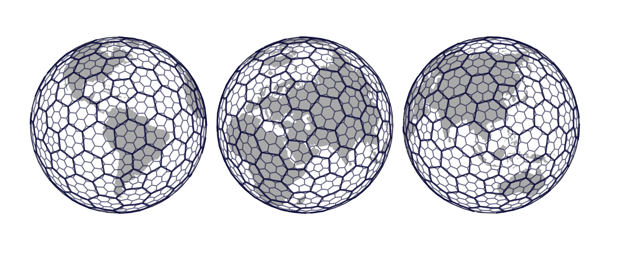
Deriving information and insights from data in the Uber marketplace requires analyzing data across an entire city. Grid systems, which partition geographic areas into identifiable cells and facilitate the exploration of data at a fine granularity, are critical to this effort. When Uber designed a grid system to bucket geospatial events, we looked to the hexagon, a shape that enabled us to minimize quantization error and easily approximate radiuses.

In 2018, Uber open sourced H3, our hexagonal grid system for visualizing geospatial data, enabling the broad adoption of this powerful and easy-to-use software. In the videos below, members of our engineering and data science teams discuss how to most effectively use H3 for geospatial indexing: Grid systems enable data analysis to abstract the messiness away from large-scale data sets for easy mathematical computations. In this presentation, Nick Rabinowitz discusses common grid operations and outlines how H3 leverages hexagons to easily aggregate and explore geospatial data from the Uber platform.

Uber leverages clusters of hexagonal cells to engineer our H3-based geospatial platform. Ankit Mehta explains why we chose hexagonal clusters over other cluster shapes and highlights how our Marketplace Intelligence team is building an efficient and scalable H3-based geospatial data platform to facilitate improved user experiences.

Source: uber.com

Tags :
Share :
comments powered by Disqus

Related Posts

Sessionizing Uber Trips in Real Time

Sessionizing Uber Trips in Real Time

Uber’s many data flows required modeling the data associated with a specific task, such as a rider trip, into a state machine. The state machine lets engineers focus on just the events needed to successfully accomplish a trip. In one sense, Uber’s challenge of efficiently matching riders and drivers in the real world comes down to the question of how to collect, store, and logically arrange data.

Read More
Faster Neural Networks Straight from JPEG

Faster Neural Networks Straight from JPEG

Uber AI Labs introduces a method for making neural networks that process images faster and more accurately by leveraging JPEG representations. Neural networks, an important tool for processing data in a variety of industries, grew from an academic research area to a cornerstone of industry over the last few years. Convolutional Neural Networks (CNNs) have been particularly useful for extracting information from images, whether classifying them, recognizing faces, or evaluating board positions in Go.

Read More
Ratings inflation on Uber and elsewhere

Ratings inflation on Uber and elsewhere

Uber asks riders to give their drivers a rating of one to five stars at the end of each trip. But very few people make use of this full scale. That’s because it’s common knowledge among Uber’s users that drivers need to maintain a certain minimum rating to work, and that leaving anything less than five stars could jeopardize their status.

Read More